The Peace River region in northern B.C. encompasses a range of geography including farmland, mountains, forest, rivers and lakes. This varied landscape offers a unique route for bikers looking to ride and explore the northeast corner of the province.
The Tumbler Ridge Circle Tour is 440-kilometre loop that can be done as day trip, but the abundance of places and things to check out make an overnighter a good option. The ride takes you through Chetwynd, Hudson’s Hope, Fort St. John, Taylor, Dawson Creek and Tumbler Ridge, travelling along the Peace River, past several lakes and near a number of attractions.
Along its eastern section, the route connects to the well-known Deh Cho route—a multi-day trip that loops up through northern B.C. via Fort Nelson into the Northwest Territories and across to Alberta.
A ride worth repeating
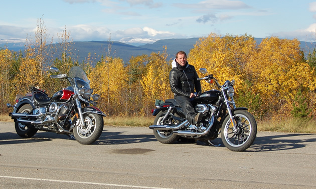
Doug Beale, a biker from Tumbler Ridge, does the Tumbler Ridge Circle Tour three or four times a year.
“June through August (offers) the best times to go, but in my opinion, it’s a fantastic ride in the fall,” Beale said. “The colours of the trees are changing and look amazing, and you can smell the berries.”
Beginning from Tumbler Ridge, riders can head northwest on Highway 29 along a stretch of hills and curves to Chetwynd.
The Gwillim Lake Lookout makes a nice stop along this section. This highway pull-out has picnic tables and trails down to Gwillim Lake, where there are more trails, a picnic area and a lakeside park.
Chetwynd offers lots of amenities. After checking out the town, continue north on Highway 29 (Don Philips Way) to Hudson’s Hope. Located in the foothills of the Rocky Mountains, this area is surrounded by forest. This scenic highway takes you past Moberly Lake, Cameron Lakes and across the Hudson’s Hope Bridge, from which the Peace Canyon Dam can easily be seen. At this point, Highway 29 curves northeastward and the road follows the Peace River into Hudson’s Hope.
A must-see attraction
If you have time, stop at the W.A.C. Bennett Dam Visitor Centre, 21 kilometres west of Hudson’s Hope; the dam overlooks Williston Lake, the largest reservoir in B.C. Along with a number of exhibits, an audiovisual theatre and a café, the centre offers guided tours of the dam—including the underground tunnels and powerhouse.
The circle tour continues northeast on Highway 29, alongside the Peace River through the rolling Peace River Valley, with its wetlands, ridges and trees. The road winds and climbs out of the valley, offering a breathtaking view all the way to Charlie Lake. It’s here you switch to Highway 97 (the Alaska Highway) and head south to Fort St. John and Taylor through prairie and farmland.
With two green spaces, Charlie Lake is a perfect spot for a packed lunch or a stop just to stretch your legs. Charlie Lake Provincial Park is on the southwest side of the lake while Beatton Provincial Park sits on the east shore; both facilities offer a picnic area, walking trails, horseshoe pits and fishing.
From bridge to bridge
Past Fort St. John is the town of Taylor. The community is situated along the Peace River and is home to the big, blue iron bridge, which replaced the original wooden Peace River suspension bridge that collapsed in 1957. The steel deck on the current bridge produces a distinct feel and sound when you drive over it.
Kiskatinaw Provincial Park lies within the community of Farmington, just north of Dawson Creek, off Highway 97. The park is situated on the banks of the Kiskatinaw River next to a historic, curved wooden trestle bridge. There is a grassy area, picnic tables, horseshoe pits and access to the river.
You are now heading into the dry prairieland of Dawson Creek, where you veer west on Highway 97 (the John Hart Highway), turning a short while later onto Highway 52 (Heritage Highway) to ride southwest towards Tumbler Ridge.
Highway 52 has limited traffic and winds through beautiful country with a dramatic view of the Rockies as you drive into Tumbler Ridge.
Some tips for the road
The semi-remote location of the Tumbler Ridge Circle Tour leaves bikers—and motorists in general—in jeopardy of encountering wildlife. Beale points out that there is no such thing as being too careful.
“Do not take chances,” he said. “Always be aware there is wildlife. Moose blend in to their surroundings and don’t reflect, and the deer are very quick. Be especially careful in areas where the roadside is quite treed close to the pavement, because the animals are hidden and then just all of a sudden appear.”


Comments