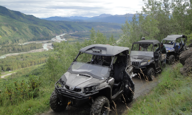
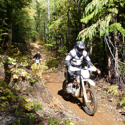
Uncover the huge hidden paydirt waiting to be unearthed in Grande Cache this summer.
Making your way to Grande Cache’s trails is made more accessible by the town’s ATV-friendly laws. Riders are allowed to use their recreation vehicles within the town limits, but only to gain access to out-of-town trails. That means that the shortest route or distance must be taken by way of back lanes and trails on the periphery of the town.
Grande Cache’s vast countryside terrain varies from easy to challenging, with some routes leading to remote areas. Be sure to carry basic emergency supplies into the wilderness. Also, keep in mind that no motorized vehicles are permitted in Willmore Wilderness Park, Sulphur Gates Provincial Recreational Area or any of the provincial campgrounds in the area.
Here are eight Grande Cache trails worth exploring on your ATV or side-by-side:
Flood Mountain
Drive south of Grande Cache on Highway 40 for approximately 10 kilometres. Just before the overpass over the railway lines by Susa Creek settlement, watch for a narrow, dirt road off to the left. This spot is a blind rise, so be cautious when turning off the highway.
Huckleberry Tower
Drive south of Grande Cache on Highway 40 for 42 kilometres. Turn left onto Goodwin Road (the old Forestry Trunk Road) and travel 35 kilometres to the Tower, or explore any of the numerous cutlines that lead in every direction.
Hoff Siding
Drive south of Grande Cache on Highway 40 for 42 kilometres. Turn right (opposite Goodwin Road) and travel five kilometres to the main cutline, which travels 18 kilometres to the Willmore Wilderness Park boundary. Numerous cutlines intersect along the way leading in every direction. Due to close proximity, be watchful that you do not enter the park.
Beaverdam Road
This popular route is located eight kilometres north of Grande Cache on Highway 40. It travels across the coal mine property and main mine road.
Caw Ridge
North of town is a popular recreation area called Caw Ridge. The alpine ridgeline is accessed by numerous old mining roads, making it a pleasant outing for riders of all skill levels. Travel 30 kilometres north on the Beaverdam Road to the Caw Ridge turnoff. From there, it is eight kilometres to the ridgetop.
Roads extend most of the length of the ridgeline and allow for multiple side adventures exploring the area. This is a fragile alpine environment, so please stay on existing trails and respect the land.
Brinkerhoff
Drive north of Grande Cache on Highway 40 for 30 kilometres, past Sheep Creek. This route is accessed from the gravel pit by the highway. Travel 37 kilometres to the slide area. You can access Prairie Creek Meadows from here, as well as explore numerous cutlines leading in all directions. Be vigilant and stay clear of any possible encroachment on mine territory.
Grande Mountain
Drive south of Grande Cache on Highway 40 for six kilometres. Just past Grande Cache Lake, there is a sign on the right-hand side that says “Carconte Creek.” Access is on the left onto the north access road. You can park just off the highway, or if you have a high-wheeled vehicle, you can alternatively drive about 100 metres up the right branch to a large clearing.
À la Pêche Lake
Drive south of Grande Cache on Highway 40 for 32 kilometres. Access to À la Pêche Lake is to the right. After traveling 24 kilometres on variable terrain that involves one river crossing, you will come to the forestry cabin. One kilometre beyond the shelter is the lake. A trail circles it part-way and there are numerous cutlines to explore here too. Stay close to the lake as some routes bring you to Willmore Wilderness Park, which is off limits.


Comments