Every June 15th, motorcycle riders across southern Alberta get psyched to access and ride a 170-kilometre stretch of pavement that spans breathtaking mountain vistas, glacier-fed lakes, churning rivers, wildflower meadows and forests that are home to every species of wildlife known to Western Canada.
“That’s the day Alberta Parks crews roll back the barricades and open a stretch of the most spectacular riding highway in the province—Kananaskis,” said Don Morberg, a.k.a. Drifter Don to local riders.
Kananaskis is a patchwork of provincial parks and recreation areas in the front range of the Rocky Mountains. The route includes the highest paved road in Canada. The summit, Highwood Pass, is 2,303 metres (7,238 feet) above sea level.
How to get there
Kananaskis is accessible from Calgary by going 75 kilometres west on Highway 1 and heeding the turnoff signs that say “Highway 40, Kananaskis Country.”
“That’s where the adventure starts,” said Drifter Don. “From my home in Calgary, it’s a 300-kilometre circular route—the perfect day ride.”
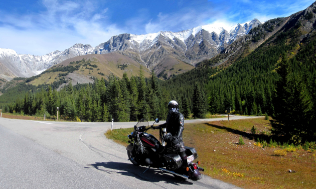
Don Morberg is a retired writer and photographer, which affords him plenty of time to ride his 2010 Victory Cross Country along Mist Creek in Kananaskis. — Photo courtesy Don Morberg
Drifter Don rides Kananaskis several times every year, with each subsequent trip seeming to have its own unique vibe.
“Highway 40 has a chameleon-like quality—it’s a different ride every month of the year.”
Fall Colours Run
The date of Drifter Don’s favourite ride was the ides of October 2017, when he and a small group of friends headed out on what they call their annual Fall Colours Run.
“Autumn is measured in hours in the Rockies,” Drifter Don said. “There is a small window when the grass glows bronze, the willow along the creeks and lakes turns brilliant red, the aspen and birch flash electric orange and yellow, and the larch near the top of the treeline turn gold. That day was clear with brilliant early autumn sun. A few days later, winter blasts came in over mountain tops, ripping all the colour from the trees.”
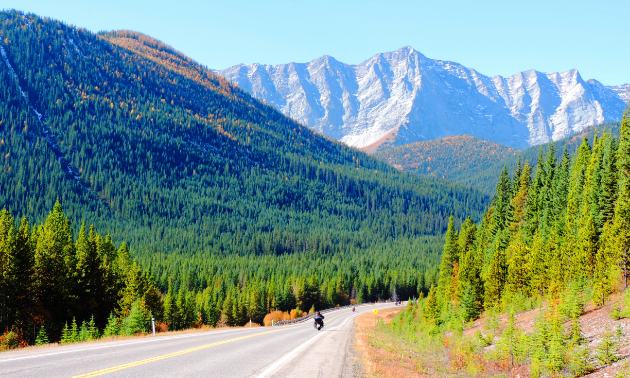
Storelk Mountain is one of the many beautiful sights to take in on a ride through Kananaskis. — Photo courtesy Don Morberg
Drifter Don’s gang rode Highway 40 from south to north, heading east on Highway 22X and then Highway 22, known as the Cowboy Trail because it bisects much of the ranching country in southern Alberta. Continuing south takes riders through Turner Valley, Black Diamond and Longview, where motorists can snag some famous beef jerky and fill up as they make their way west on Highway 541 through the rolling grazing lands and working ranches of the Rocky Mountain foothills.
“Traffic is always sparse on this route into Kananaskis,” said Drifter Don. “The first peaks of the Rockies front range appear ahead of us as we dive through a canyon carved by the Highwood River eons ago. Keep careful watch here because this is open-range country. Hundreds of soon-to-be-cheeseburger bovines don’t respect passing motorcycles.”
A fork in the road
Highway 40 technically starts at the Highwood Junction. Going south from this point takes riders down Highway 940, an unpaved road popular with dirt bikers and ATVers that leads to Crowsnest Pass. Drifter Don and his buddies head north along Highway 40 through parkland that includes nine different provincial parks and recreation areas stacked together one after the other. Services along this stretch include scenic pull-offs, outhouses, picnic sites, interpretive signage and stubborn sheep.
“Grazing cattle give way to suicidal mountain sheep that seem to still think they have the right of way and sometimes can’t be reasoned with,” Drifter Don said.
“Highway 40 starts to climb as we head north through the Mist Creek area with its hidden hot springs and jagged sawtooth mountains. We dodge more mountain sheep as we crest the Highwood Pass. That is a must-stop site. It’s one of the few areas in Canada where you can park and walk a few feet into an alpine meadow. During the fall, it’s a blaze of colour from the grass at your feet to the golden larches up to treeline.”
Winter is coming—but not yet
Highway 40 winds through a series of curves until it evens out at the 1,800-metre level where the road to Peter Lougheed Provincial Park joins the highway. The vast vista of the Kananaskis River Valley is on the left and the Opal Range mountains are on the right.
“It was October and there was a whiff of winter in the wind coming down from the peaks to the west,” Drifter Don said.
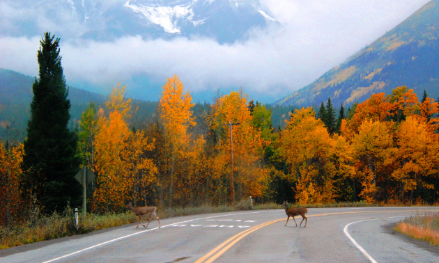
Riders need to watch out for a variety of wildlife along Highway 40. — Photo courtesy Don Morberg
Shrugging off the chill of pending winter, Drifter Don continued into the more-developed end of Highway 40, which has year-round facilities and visitor centres. The road cuts through one more mountain pass between Mount Kidd and The Wedge and then sails past a golf course and an RV park. Lunch options include Boundary Ranch with its cowboy cuisine or one of several restaurants at Kananaskis Village, a mountain resort near the site of the 1988 Winter Olympics downhill ski facility.
“We opted for Woody’s Pub,” Drifter Don said. “It’s got great hamburgers and spectacular views of the valley and surrounding mountains.”
The conclusion of the trip takes riders to the top end of Highway 40 to photogenic Barrier Lake with the remnants of a second World War prisoner-of-war camp nearby. The last landmark is the Stoney Nakoda Resort & Casino as riders exit Highway 40 onto Highway 1 on their way back to Calgary.
“Another great day and great ride,” said Drifter Don. “If I had to pick one of the 50 or so rides I’ve done there as a favourite, I’d have to say it was that one.”




Comments