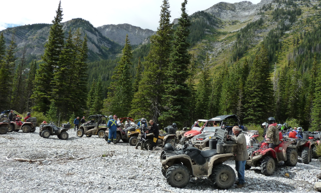
The Crowsnest Pass Quad Squad (CPQS) has constructed quite the trail system within southwest Alberta. “We’re very much into bridge building to keep wheels out of the water,” said Peter Reed, director of the CPQS and vice-president of the Alberta Off Highway Vehicle Association. “We've been busy expanding the bridges so they'll handle 70-inch machines.”

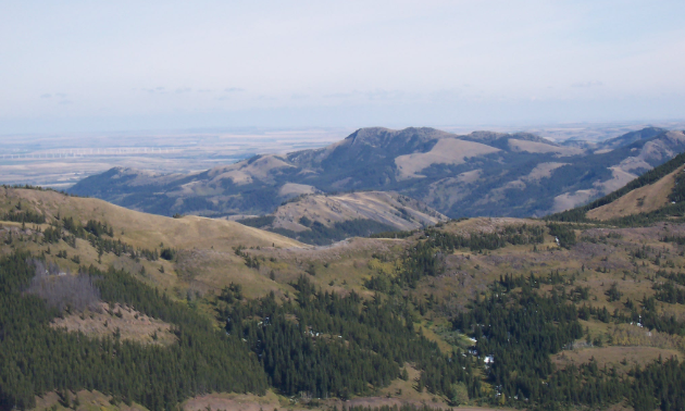
On the top of the Adanac is a large, old strip mine towards Willoughby Ridge and the Eastern Plains. — Photo courtesy Peter Reed
Reed knows the Crowsnest Pass extensively and has been involved with the CPQS since 1995. “I've been riding since dirt was invented,” he laughed. “I started with farming and it’s grown from there with hunting, fishing and wanting to be involved in the community of riding to make things better.”
Ghost Town Lille
The Crowsnest Pass has plenty of beginner and intermediate trails that lead to comfy campsites, old forestry roads and ghosty vistas. “There's an incredible little ride north out of Frank that takes you into the ghost town of Lille that we put some bridges in,” Reed said. “It's treed and scenic all the way in. There are some cement buildings that they used to keep the powder in as well as old coking ovens from the coal mine that was there.”
Willoughby Ridge
Willoughby Ridge is a historical trail that's been used to take coal and lumber out of the Carbondale area. “You can see west to the mountains, to the rugged peaks, which aren't that far away,” Reed said. “To the east, you can see as far as Pincher Creek and the St. Mary's Reservoir.
“You have to be careful as you go through the Crowsnest Pass ’cause there's often bighorn sheep on the road,” he said. You can also expect to see elk, mule deer, whitetail deer and “every kind of bear you can ever imagine.”
Lost Creek
The Lost Creek area offers several loops of enjoyable beginner to moderate riding, including old mining and forestry roads and trails that have been partially reclaimed and are fairly rugged in some spots. On the top of the Adanac is a large, old strip mine towards Willoughby Ridge and the Eastern Plains. A deep valley lies on both sides of the mine site, providing access to trails that lead to nice camping areas.
Camping
Campgrounds can be found at Lynx Creek, the Castle River Falls and dispersed north on the Sartoris. “It's good, rustic backcountry camping,” Reed said. “There are streams near by and decent, flat places to park your camper or tent.” Keep in mind, you're not allowed to ride the forestry roads from one site to the next so you have to trail from one trailhead to the next.
Staging
Access to staging areas can be found off of Sartoris Road on the north end and beside Gorge Creek on the south side. For easy navigation, use the Crowsnest Pass Quad Squad website to download maps. If you're going to camp, contact the forestry office in Blairmore for the most current information.

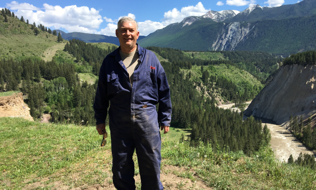
“I'm a cancer survivor and I get to a lot of places with the ATV that I'd never be able to walk to.” — Peter Reed. — Photo courtesy Peter Reed
As nice as it is to ride through the Crowsnest Pass on an ATV, the ability to do so won’t be available for much longer. “These are all trails that are going to be closed down by the end of next year,” Reed said.
Read about what’s happening on the Alberta Off Highway Vehicle Association website. Then, voice your support for the Crowsnest Pass Quad Squad and their efforts to keep their trails open.
On our Rad Radar
Rad rider: Peter Reed
Where: Calgary
Occupation: Health and safety professional
Weapon of choice: 700 Arctic Cat H1 and Hisun 800 side-by-side


Comments