
British Columbia has a long and storied mining history.
Fabled tales of striking the motherlode run rampant, though in actual fact very few struck it rich and more often than not miners left with little more than they arrived, except for fantastic tales of adventure in the B.C. wilderness.
As mineral deposits ran dry, the miners left and many boomtowns went bust.
Such was the case for Sandon, located in the Slocan Valley just outside of New Denver, B.C. In its heyday Sandon boasted 29 hotels, 28 saloons, one of the largest "red light" districts in Western Canada and over 5,000 residents.
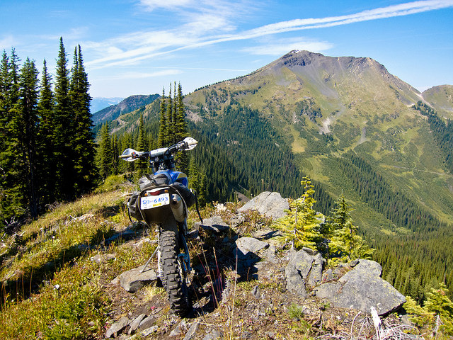
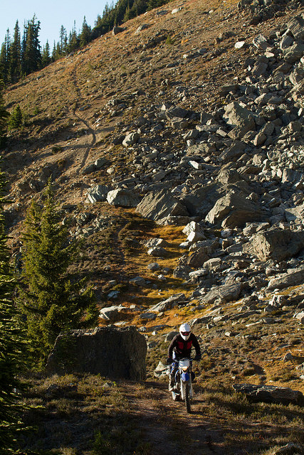
Singletrack on Reco Pass near Sandon, B.C. — Photo courtesy Steve Shannon Photography
Prospectors, all looking to strike it rich on silver, peppered the hillsides with mining claims. Railways competed to be first into the area and hardy miners built trails, then roads high into the mountains to haul ore to market.
As the mineral veins fell short and floods and fires ravaged the town, miners moved on to other areas and Sandon slowly faded into the mountainsides. These days there are less than 10 full-time residents and little more than a museum left.
Thankfully while the town is nothing more than a ghost of its former size, the hillsides remain rich with old mining and logging roads just waiting to be explored.
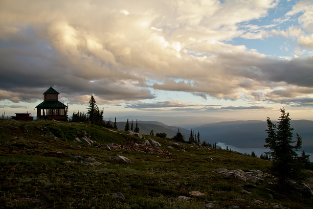
Sugar Mountain Fire Lookout at sunset. — Photo courtesy Steve Shannon Photography
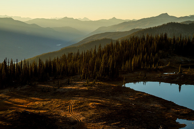
Starting right from town, the Idaho Peak road extends 12 kilometres up the mountainside to an alpine ridge line. The road is well maintained and suitable for large adventure bikes as well as smaller machines. From the ridge line parking lot a short hike leads to the historic forest fire lookout on the peak, with fabulous views of Slocan Lake and both the Kokanee and Valhalla ranges.
Though now defunct, this lookout used to be manned every summer by rangers from the British Columbia forest service keeping a careful watch for wildfires. The lookout is the highlight, but there are also plenty of old mine sites to explore around Idaho Peak and Silver Ridge.
One of the most spectacular mine sites is located a short walk down the Wakefield Trail. The shaft entrance has collapsed, but two rails still extend from the mountainside into thin air offering a spectacular view.
For the more adventurous, continuing up Carpenter Creek to the old townsite of Cody is a must.
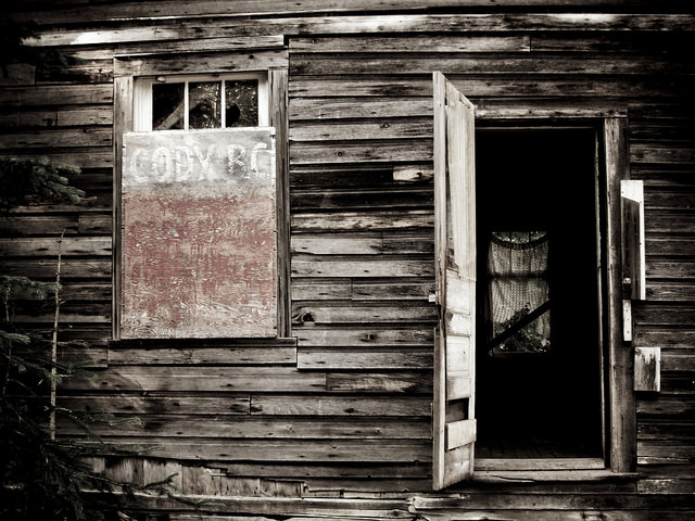
Remains in the ghost town of Cody, B.C. — Photo courtesy Steve Shannon Photography
From Cody you can hike to the Noble Five mine site below Silver Ridge, or a better option is to ride an old mining road climbing up the side of Reco Mountain, using almost 30 switchbacks to reach Reco Pass.
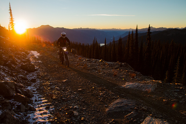
Steve Shannon, taking in the scenery on his ride. — Photo courtesy Steve Shannon Photography
This historical trail brought the ore down from the mountaintops into town where it was weighed, graded and sent off to be refined. The old road passes numerous old mine sites, compressor stations and other old buildings as it steadily climbs from valley bottom to alpine ridge line.
The views from the pass are simply outstanding. Further exploration of the surrounding mining roads will reveal even more mine sites.
Continuing over the pass and down the Stenson forest service road to Retallack and Zincton leads to more historical remnants.
The abandoned K&S Railway leads from Retallack past Fish Lake and onwards through the ruins of Zincton. Past Zincton a mixture of newer logging roads and old mining trails traverse Payne Mountain, passing numerous old mine sites before descending back to Sandon.
Sandon is located in the heart of the West Kootenay, a short detour off Highway 31A. The nearest town is New Denver, 13 kilometres west on the shores of Slocan Lake. Kaslo is the next closest town, located 45 kilometres to the east on the shores of Kootenay Lake. The largest centre in the area is Nelson, which is 115 kilometres south of Sandon. Food, gas and lodging options (both camping and hotels) can be found in all three towns.
For dual sport enthusiasts the paved highways in the area are all highly recommended rides.
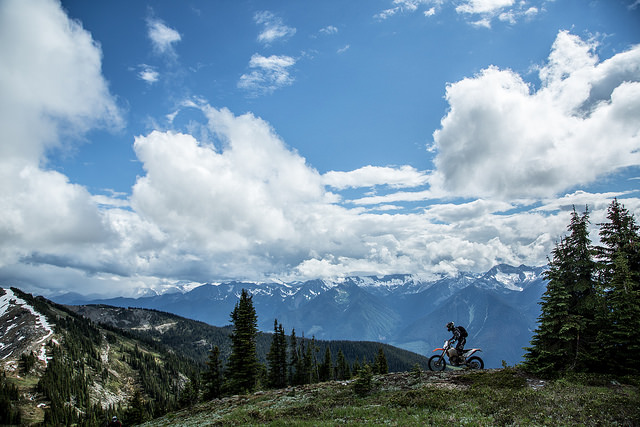
Steve Shannon riding down Silvercup Ridge at Trout Lake, B.C. — Photo courtesy Steve Shannon Photography
Trout Lake and Silvercup Ridge
Trout Lake sits nestled in the Lardeau Valley northeast of Nakusp on Highway 31. Known as a sleepy fishing and vacation destination, it wasn’t always so quiet. A rich mining history centred around Silvercup Ridge has made the area perfect for the off-road adventurer. A network of old mining roads lead into the alpine where it was easier for miners to spot the veins of ore. Three main access points along Highway 31 lead up Silvercup Ridge: Rue de Beau at the north end, Rady Road in the middle and American Creek at the south. Triune Mine can also be explored on the backside of Silvercup Ridge, accessed from the ghost town of Ferguson.
The Golden hour at Silvercup Ridge, Trout Lake, B.C. — Photo courtesy Steve Shannon Photography
Other areas to explore include Healy Creek, or Beaton, Camborne and the Incommapleux Valley.
Steve Shannon Silvercup Ridge riding the trails to Trout Lake, B.C. — Photo courtesy Steve Shannon Photography
Up on Sugar Mountain
Just downstream of the headwaters of the Shuswap River, north of Cherryville, is Sugar Mountain. Situated on the edge of the mighty Monashee Mountains with an expansive view of the Shuswap drainage, Sugar Mountain served as a strategic lookout point for the British Columbia forest service.
These days airplanes, satellites and cellphones have replaced field lookouts, but the old buildings remain as welcome shelter and a pleasant reminder of British Columbia’s rich history. From Vernon, go east on Highway 6 to Cherryville, then follow the signs north to Sugar Lake. From Sugar Lake, follow the Kate forest service road along the eastern shores before climbing the rough road up to the lookout. Loose rock and washouts litter the road but the view from the top is well worth the effort.


Comments