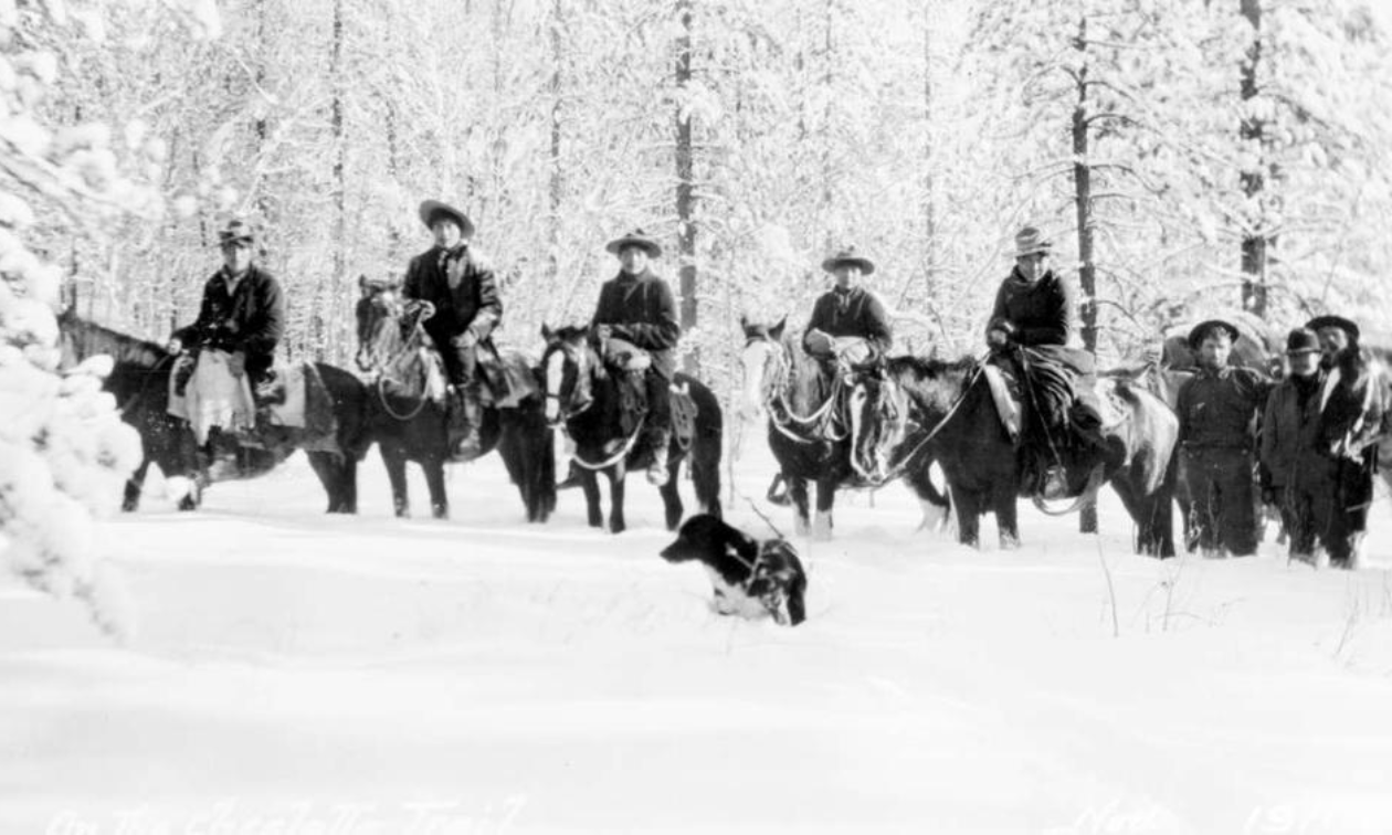
When riding the historic Cheslatta Trail, near Burns Lake, B.C., you realize very quickly that it is a special place. Your instinct might be to protect its location so that it isn’t damaged through carelessness. But trails can literally disappear (industrial activities, wildfire, mountain pine beetle, etc.) if they are not utilized and maintained. This trail also presents a greater opportunity to understand the forces and events (land claim issues and the impacts of early industrial mega projects) that are a part of North Central B.C.’s history.

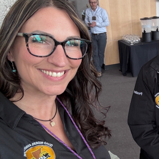
The Cheslatta Trail has been utilized by humans for thousands of years. The 80-plus-kilometre-long trail follows along the shore of Cheslatta Lake and continues to Murray Lake. — Photo courtesy Tracey Payne
The trail along Cheslatta Lake was part of a vast network of trails established across the province by First Nations people (The word Cheslatta means “top of small mountain” or “small rock mountain at east side” in the Carrier language). These trails were the way into the interior of British Columbia, and utilized by early European explorers and then again during the development of the fur trade. One trail ran from the foot of Ootsa Lake to Cheslatta Lake and then onto Fort Fraser where the North West Company had established a fur trading post in 1806. The Cheslatta Trail also connected with a trail that ran from Francois Lake to Fraser Lake and then onto Stuart Lake. This trail from Fort St. James is called “Nyan Wheti,” meaning “the trail across.” And the Bella Coola “grease” trail, which crossed between Cheslatta Lake and Murray Lake, was an important route used for trading eulachon oil from the coast. The eulachon (also oolichan, hooligan, ooligan, or candlefish) is a small anadromous ocean fish, a smelt found along the Pacific coast of North America from northern California to Alaska. Nearly 15 per cent of their body weight is fat. Eulachon are processed for their rich oil. The usual method is to allow the fish to decompose for a week or more in a pit in the ground, then add boiling water and skim off the oil, which rises to the surface. Pre contact, Eulachon oil (also known as “grease”) was the most important product traded into the Interior.
Famous folks
It’s exciting to travel down a trail that was used by so many well-known historical figures from the colonial era. Charles Horetsky walked into the area in 1874 searching for a route for the transcontinental railway. There was an early Catholic Church built at Scatchola in 1864. And Catholic missionary Father A.G. Morice used the trails in 1890. At the turn of the century, settlers and trappers began moving into the Ootsa Lake country, travelling from the rail terminus, at Ashcroft, B.C. In 1906, a young Barney Mulvaney, who is considered the founder of my home town of Burns Lake, B.C., traveled the trail by dog sled. This trip took him from Quesnel to Hazelton and then to the Nass Valley and back to Quesnel in late winter. Imagine what kind of grit was required for that kind of travel.
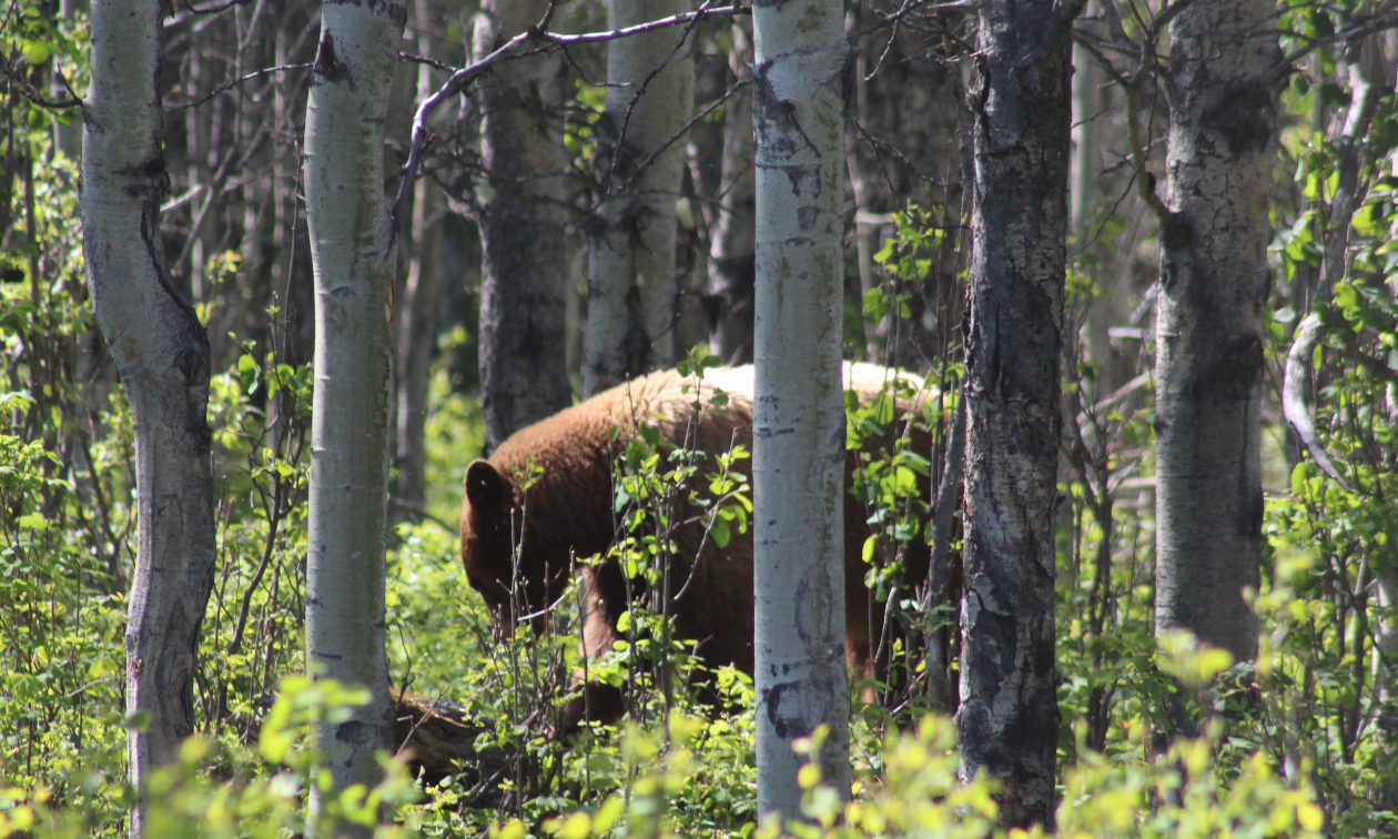
Black bears, grizzlies and other wildlife are always abundant along this trail. There is substantial feed available to them on the south-facing slopes around Cheslatta Lake. They are always curious and easy to photograph. Perhaps because of the relative isolation, they are unaccustomed to the sound of engines. — Photo courtesy Tracey Payne
The Cheslatta Trail intersects with so much of the shared history between First Nations people and the predominately white settlers of north central British Columbia, from its long human occupation along an important grease trail leading from the coast line to the construction of the Kenny Dam in the 1950’s by Alcan of Canada.
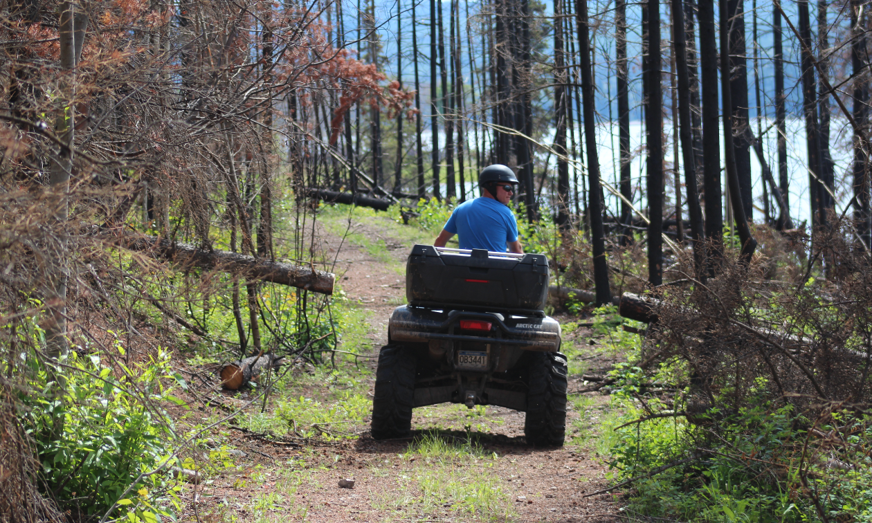
This section of the Cheslatta Trail was burnt during the wildfires of 2018. It is interesting to see how the forest cover reacts to the severe burning. As of the spring of 2021, it is rapidly greening up with the return of the shrub layer of vegetation. — Photo courtesy Tracey Payne
When you travel down the Cheslatta Trail, think about how the Ootsa Lake Reservoir was formed. In 1952 the construction of Kenney Dam (the third largest rock-filled dam in the world) diverted the Nechako River and linked the rivers and lakes of Cheslatta, Intata, Whitesail, Chelaslie, Tetachuck, Tahtsa and Natalkus into a reservoir with a surface area of 90,000 hectares (145 miles long and covers 339 square miles). The men overseeing the operation saw no issues with reversing the water flow of these lakes and rivers westward to the Pacific Ocean to produce hydro electricity for the aluminum smelters at Kitimat, B.C. The water level of Ootsa Lake was raised 46 metres (150 feet). The subsequent flooding displaced all the people of the Cheslatta Carrier Nation and 79 non-native families. The Cheslatta people were given less than two weeks' notice and very little compensation. The social impacts continue to this day. The flooding is one of the most significant, environmental and cultural events in the history of the Lakes District.
What to see along the way
Some highlights of this route include a few kilometres of trail along the fluvial plain of the Cheslatta River. The significant scoring of the shoreline from the release of the spring freshet through the Skins Spillway on Ootsa Lake. The water levels in the river and along the shoreline can fluctuate up to 15 meters (50 feet) during a release of water from the Skins Spillway. The high wildlife values found along the south facing aspen slopes along Cheslatta Lake mean that deer, moose, and bears are abundant. For those interested in geology, a large section of the trail skirts Tyee Butte, a volcanic cap of columnar basalt. More recently, there is some interesting fire ecology occurring where the wildfires from the summer of 2018 impacted the middle section of the trail.
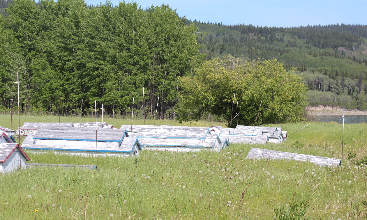
Grave houses at Sather Creek. These coffin-sized structures normally lie atop graves and are meant to shelter the spirits of the remains buried in the ground beneath. Due to the large fluctuation in water levels the Cheslatta people have had to resort to marking grave sites with long metal rods bearing small crosses to mark the location of graves. At some points in the early spring, these houses are removed and placed onto higher ground until the flood waters released from the Skins Spillway recede. — Photo courtesy Tracey Payne
It takes some effort to get to Cheslatta Lake and the old village site of Skatchola (IR #5), but it is worth making the long trip. Please note that the Cheslatta Carrier Nation deserves respect for the cemeteries, cultural sites and infrastructure found there. Both Christian and ancient burial sites can be found along the lake and river (about 200 of them). The most obvious is the collection of 30 grave houses at Sather Creek. A sharp eye is needed to pick out the trail that leads up the slope behind the modern community grounds to the cairn that consecrates the whole lake as a final resting place. Along with the 10-foot tall rock cairn, there is a small group of grave markers. One of the headstones found in this location is inscribed with Carrier or Dene syllabics, Dulkw’ahke (meaning toad feet) is a script created by Father A.G. Morice for the Carrier language. It was inspired by Cree syllabics. Its usage began to decline around 1920, when the Carrier language was banned from local schools.
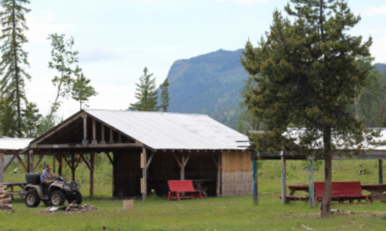
The Cheslatta Carrier Nation Community Grounds at the end of the Sather FSR with Tyee Butte in the background. This is the location of the old village of Skatchola. This is about 20 kilometres from Cheslatta Road where you can park your truck. This is a protected spot for lunch if the weather is threatening. Both Sather Creek and Ootsanee Creek flow into Cheslatta Lake at this point. — Photo courtesy Tracey Payne
Please respect the significance of this trail and treat it with care. For some ATV riders, gravel and sand bars are for ripping and tearing. ATV riders should know that these sensitive riparian areas are easily damaged. Please stay off the hillsides and out of the wetlands. And please pack out your litter.
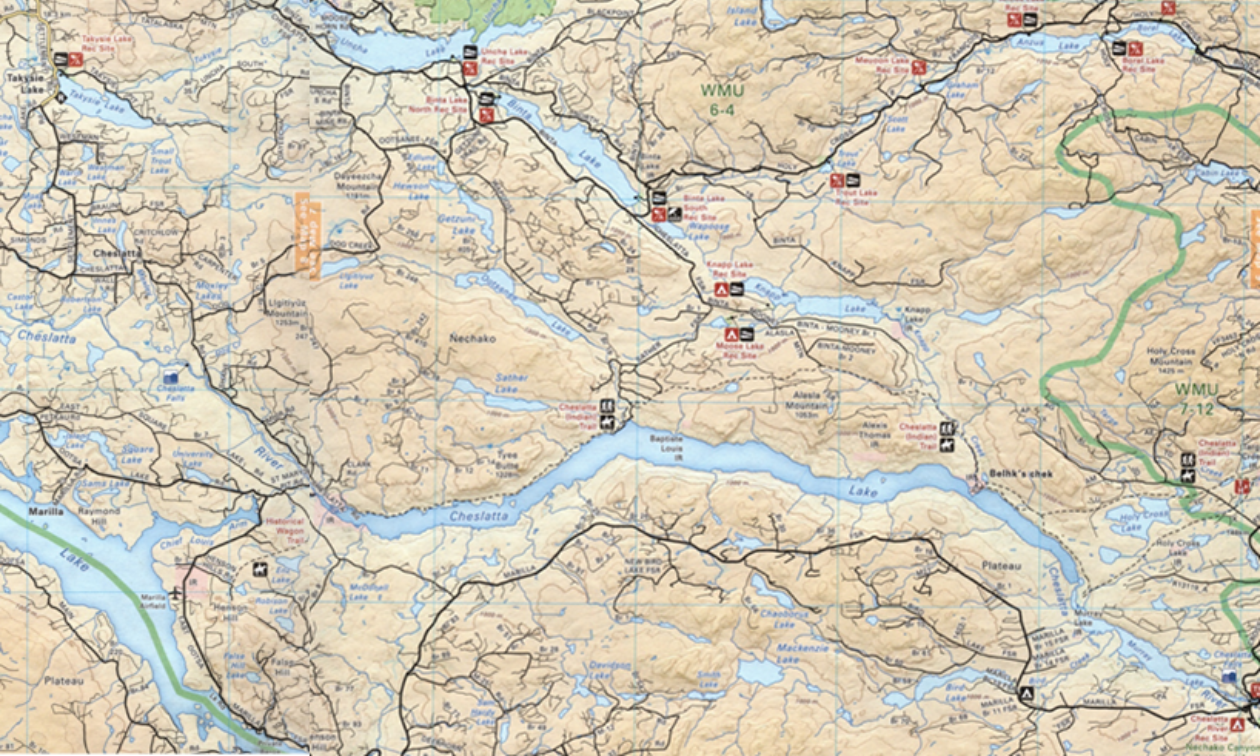
A trail map highlighting the Cheslatta Trail. — Image courtesy Tracey Payne
How to access Cheslatta Trail
There are four access points along the Cheslatta Trail. I recommend using the Backroad Mapbook: Northern BC. We typically camp the night before at Takysie Lake Resort or at the Skins Spillway Campground and use the Cheslatta Road for access. If you are using the Sather FSR for access, there is good camping at the Binta Lake South Recreation Site.
Access Route #1 – Cheslatta Road (best route)
Once exiting the Southbank Ferry Terminal, drive straight up the hill on Keefe’s Landing Road following signs to Takysie Lake Resort – 23 kilometres. Continue past Takysie Lake travelling south on the Eakin Settlement Road for 10.5 kilometres to the Cheslatta Road Junction. Turn left and travel on Cheslatta Road for another approximately 10 kilometres to the trailhead. Once you pass Radtke Road on the left hand side, the unsigned trailhead and parking lot are at the next right hand road. This unmarked trailhead looks like a skid road. There is a road identification sign near here that says Clark Road.
Access Route #2 - Sather FSR
This is the route to take if you are traveling by automobile. Take a picnic and enjoy the shores of beautiful Cheslatta Lake.
Access Route #3
Alaska Mountain FSR traveling from Binta Lake Area.
Access Route #4
Holy Cross FSR traveling from Lejac on Highway 16 near Fraser Lake, B.C.


Comments