I’m still shaking my head in amazement; 18,000 kilometres, all the planning and it’s over. It is difficult to describe in just a few short pages the beauty of Canada and to express my enjoyment on so many different levels, on so many different roads.
It had been mid-June and I had been excited to head to Vancouver Island, B.C., to visit my daughter, our newest grandbaby and my son-in-law. To change it up, rather than just head west from Edmonton, Alberta, I rode south to the Crowsnest Pass, then westerly through Sparwood and Fernie, British Columbia, with a stop to see the folks with RidersWest in Cranbrook.
The trip westerly through the mountain passes was, at times, breathtaking. The descent through the twisties into the valley floor below to Osoyoos—with Lake Osoyoos and its orchards and wineries—was certainly memorable. Reportedly, Osoyoos is the only desert in Canada.
Westerly, after Osoyoos and back into the mountain passes again, I saw the temperature plummet from 10 C to 4 C. At one place, a large tree had fallen and was blocking both eastbound lanes. The lakes were still ice-covered, and I was treated to fresh falling snow.
After I left the mountains, though, the ride was summer all the way to the Vancouver Island Ferry at Tsawwassen, B.C.
The following are six of the most memorable routes I travelled. They are listed in the order they unfolded during my adventure, not in order of preference.
1. Pacific Rim Highway (B.C. Highway 4), Vancouver Island
To coin a phrase used by the locals on Vancouver Island, my son-in-law, Kirby (who I had picked up in Victoria), and I headed “up Island” towards Nanaimo. Our goal was Tofino, well-known for camping, surfing and many other outdoor activities.
B.C. Highway 4, west of Port Alberni, is known as the Pacific Rim Highway. This section became more interesting the further west we rode. It was full of twisties, blind corners, climbs and descents, and the forests towered over us and often blocked out the sun.
Tofino, B.C., was Wayne Hamm’s most westerly destination. He got this photo while hiking near Chesterman Beach in Tofino. — Wayne Hamm photo
The ride through Sutton Pass was notable and it gave us a quick peak at a snow-covered mountaintop. When we neared the junction for Ucluelet and Tofino, we could smell and taste the salty air off the ocean. There was more than ample camping and numerous wooded walking trails there, allowing us to explore the beaches. I later learned, while at a food truck in Tofino, that the huge trees towering over us were Douglas firs.
We doubled back to Vancouver on Highway 4, and again the ride was a treat.
2. The Sea-to-Sky Highway (B.C. Highway 99)
The ferry ride from Nanaimo to mainland B.C. was very scenic and relaxing. After the ferry docked in Horseshoe Bay, West Vancouver, and within mere minutes and without traffic hassles, I went north on the Sea-to-Sky Highway—aptly named due to its climbs, descents and ocean and mountain views.
There were snow-covered peaks when I was there, and in some ditches, mounds of leftover snow from winter slides. The road snakes through Squamish, Whistler, Pemberton and then through semi-arid Lillooet.
Between Pemberton and Lillooet, the road is at its best. The twisties, descents and 20-kilometre per hour hairpins were welcomed. You know you are on a road made for motorcycles when there is an abundance of brake check pullouts, runaway lanes and the smell of burned brakes in the air!
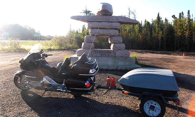
3. Alberta Highway 55 to Kenora, Ontario, via Saskatchewan Highway 106 and Manitoba highways 39, 6, 68, 9 and 44
(This route included a portion of the Northern Woods and Water Route, and it allowed me to enjoy northern Saskatchewan and northern Manitoba.)
My goal for this trip was to ride the roads less travelled whenever possible. I headed northeast from Edmonton towards Cold Lake, Alberta, where I would connect with Highway 55. It didn’t take long to escape the hurried and frustrating stop-and-go traffic. The scenery initially was prairie-like with the sweet smell and eye-catching yellow of early canola crops and the smell of fresh-cut grass that I suspected was drying hay.
As I neared Cold Lake, the scenery became more forest-like. From Cold Lake, I headed south on Highway 28, reconnected with Highway 55 and headed east along what is known as the Northern Woods and Water Route. At that point, the tailgaters were gone, the road was practically deserted and I was able to sit back, enjoy the scenery and cruise well below the posted speed, all the while smiling out loud.
If you travel this route, you will likely find yourself relaxed and, like me, alone in your thoughts with a realization of what is really important. Eventually, I turned off Highway 55 and headed north along Saskatchewan Highway 106. Along the way, I made note of a sign at Smeaton, Saskatchewan, that stated "Where the North Begins." Here, I was treated to the sight of many lakes, a high water table with its enjoyable smells and lots of wildlife (including deer, bear, geese and turkey vultures). Then, like the flick of a switch, there was a transition from the lushness of the water and forests to rock and mining near Flin Flon, Manitoba.
From Flin Flon, I headed east on Manitoba Highway 39 towards Ponton, then turned south on Highway 6 and went through Grand Rapids, passing by Lake Winnipeg and eventually reaching Gimli. The Gimli Glider of many years ago is worth a Google search.
I escaped the Winnipeg traffic by heading east on Highway 44 through a delightful road full of twisties and lake views. I passed through West Hawk Lake and Falcon Lake before I entered Ontario just west of Kenora.
There are important factors to consider if you choose to ride this route. One is to be sure your ride is well maintained and you have gear for all conditions. The fuel stops and accommodations are sparse, and there are sections of gravel. I dodged the gravel merely by researching the route—so do your homework. (Thank you to Riverside Honda & Ski-Doo in St. Albert, Alberta, for tweaking my baby and even giving her a bath before I embarked.)
4. Ontario Highway 11 to Trois-Rivieres, Quebec, via Quebec Highway 117 and Quebec Highway 158
(East of Thunder Bay, Ontario, I took Ontario Highway 11 at Nipigon and continued east to Kirkland Lake, Ontario. Entering Quebec east of Kirkland Lake on Quebec Highway 117, I continued southeast on Quebec Highway 117 until St. Jerome, Quebec. To avoid the rigours of the Montreal traffic, I headed east on Quebec Highway 158 and crossed the St. Lawrence River at Trois-Rivieres.)
My idea of motorcycling is to not compete with countless cars and trucks on some multi-lane highway. Ontario and Quebec are huge provinces with major centres, such as Toronto, Montreal and Quebec City. I managed to avoid all the stresses and dangers of fast-moving heavy city traffic by taking the above route.

The Toburn Gold Mine at the east entrance of Kirkland Lake, Ontario, pays tribute to the town’s mining history. — Wayne Hamm photo
As I neared Kirkland Lake and entered Quebec, I was intrigued as I passed by several active gold mines. The ride southeast in Quebec on Highway 117 was very relaxing and enjoyable, and traffic was sparse. East of Val-d’or, I passed through a vast wilderness with countless lakes and dozens of primitive tent sites in one of which I pitched a tent for the night.
I travelled through several quaint communities, such as Louvicourt, Mont-Laurier, and Mont-Tremblant. Mont-Tremblant is a popular ski resort in the Laurentian Mountains and reportedly hosts even the rich and famous from Hollywood. Its idle ski lifts could be seen off in the distance as I passed. The ride across the vast St. Lawrence River at Trois-Rivieres was a breeze.
5. The Confederation Bridge
The Confederation Bridge is of special interest to me. It spans the Northumberland Strait and links my home province of Prince Edward Island to New Brunswick. At 12.9 kilometres long, it is reportedly the longest bridge in the world crossing over ice-covered waters. Also called the “Fixed Link” by some, the bridge curves and arches upward and is truly a marvel to see.
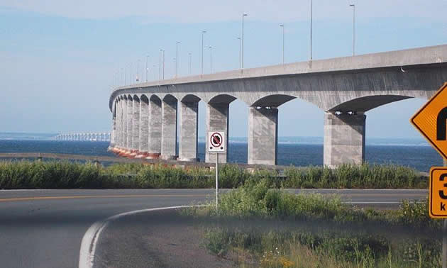
The Confederation Bridge links Prince Edward Island with mainland New Brunswick. This photo was taken from the New Brunswick side. — Wayne Hamm photo
The beauty seems even more pronounced from the seat of a motorcycle. The smell of the salt air, view of P.E.I., and the local fishing boats were inspiring.
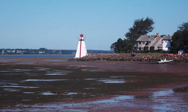
Victoria Park is a waterfront park in the city of Charlottetown, Prince Edward Island. This photo was taken at low tide at Victoria Park. — Wayne Hamm photo
6. Twillingate, Newfoundland, via Highway 320 and Highway 330
(From the town of Gambo, Newfoundland, I followed Highway 320 north and headed northwest on Highway 330 and rode towards Musgrave Harbour. Then I went towards Gander Bay and continued northwest towards Twillingate, Newfoundland.)
This ride hugged the coastline and passed by many quaint fishing villages, with endless views of the Atlantic Ocean, and traffic was almost non-existent. We tented near Musgrave Harbour within spitting distance of the ocean, and the sounds of the waves lapping at the shoreline lulled us to sleep. As we neared Twillingate, which is known as the Iceberg Capital of the World, we noted eye-catching signage to places such as Herring Neck and Crow Head.
Twillingate itself is a small island and did not disappoint us. We watched several icebergs that were close enough to us that we could hear them crackling and falling apart.
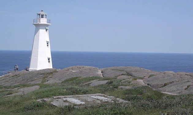
The coastline of Newfoundland is beautiful. Here is a lighthouse at Cape Spear. — Wayne Hamm photo
This brief writing highlighting Twillingate cannot begin to portray the beauty and the sightseeing opportunities available on The Island of Newfoundland. There are likely hundreds, perhaps thousands, of roads that hug its beautiful coastline.
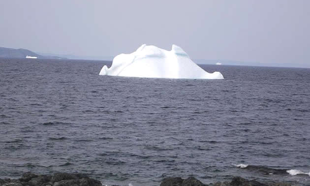
Twillingate, Newfoundland, is known as the Iceberg Capital of the World, and rightly so. — Wayne Hamm photo
She was the boss
Stay tuned for a wrap-up of this adventure. It was life-changing, but it wasn’t all perfect. Mother Nature had her way with us on several occasions!
Editor's note: You can also read about the people Wayne Hamm met along the way in part 1 of this series, Crossing Canada and Meeting New People Enroute. And for an explanation of why Hamm embarked on this cross-Canada trip, read From Shore to Shore With A Message In A Bottle.
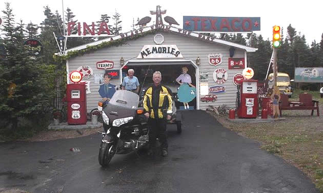
Wayne Hamm found this small private car museum while riding through the Codroy Valley in the southwestern part of Newfoundland. — Wayne Hamm photo


Comments